Here we sit. High winds up to 25 knts. High waves, small craft warning. Oh well, not much you can do. Taking to the boater next door who boats these waters all the time, he say 1 day of every 4 is Ok at this time of year. Thursday looks like it might be Ok, but then they are predicting gale force winds on Friday. At least we are in a nice town.
156 miles to Chicago and there appears to be harbors of refuge every 20 or 30m miles from now on. We jsut have to wait the weather out. Brenda is concerned about the fellow and his wife that we met in Gore Bay. He is a French citizen and can't get his cruising permit to get back into the US until September 4. He could be in for lots of fun.
Anyways we will see what tomorrow will bring. If Thursday is OK we will leave early and do a good run.
Tuesday, August 31, 2010
Monday, August 30, 2010
Monday - August 30, 2010


Left a little late this morning - 11:00 am. However the lake was relatively good and the waves were about 2 feet. We thought we would head to Pentwater. The journey was uneventful for the most part, except that Brenda noticed a couple of fenders floating in the water, but they were too small to pick up. At the same time we noticed a couple of flags floating about 500 feet on the other side of the boat. We thought they were just marking a sailing route. Wrong. When we arrived in port, we learned that they marked the outer edges of an underwater fishing net and we ran right between them. Fortunately the net was deeper than my draft so we did not catch anything, but there eno notifications on the charts or anywhere else prior to leaving Manistee. We were lucky that we did not get hung up.
Anyway, we continue on our journey and the waves started building. Around Ludington they were running about 5 feet, so we decided to go in for the night.
Ludington, like so many other towns on Lake Michigan was developed as a port to ship timber and as a vacation home for the wealthy. It is a nice little town with lots of crafty type stores and a beautiful park that runs along the waterfront.The park ahs all sorts of statues that commemorate something that has happened in the past. Good restaurants also. The marina was far better than that in Manistee and it appears that they have spent quite a bit of money developing it and the park.
Ludington also has the last car ferry on Lake Michigan and runs over to Wisconsin every day. The ferry is coal fired. I didn't think that they allowed them these days.
It looks like we may be here for another day as the winds are forecasted to go to 25 kts tomorrow, but at least we made some progress with two good weather days.
Sunday, August 29, 2010
Sunday - August 29, 2010


Been out a month now.
Finally the wind died down and we left Leyland this morning at 8:30 am. As soon as we got outside the breakwall at Leyland, I put the boat on Autopilot and didn't take it off till we arrived at our final destination at 3:45. It makes it an easy day because to change course all you have to do is reset for a different bearing. We originally were going to go to Frankfort, then we decided Arcadia which was about 10 miles down the lake. However when we reached Arcadia at 2, the lake was so goo that we decided to go on Manistee which is a further 15 miles down the Lake.
One thing that is interesting though is the huge sand dunes and beaches all along the eastern side of Lake Michigan. Apparently, the prevailing wind is from the west all along the lake and over a million years the waves and water have created the sand. Quite impressive!
Not much to this town though the books said it was a quaint Victorian city. While it is Sunday, there is no-one in town. A lot of stores on the main street have closed up or are for sale. Two restaurants were open. Not much here that we can see and we will move on tomorrow.
Saturday, August 28, 2010
Saturday - August 28, 2010
Well, we're still in Leland, but the winds are dropping and it looks like a go tomorrow morning. Talking to a sailor here and he has to get to work on Monday across the Lake, so he is leaving at 3 am this morning for the 12 - 14 hr trip. I think we will leave as early as possible but after we get a holding tank pump out and see how far we can get. I am not sure the weather won't change after tomorrow so we should go as far as possible.
Since we were not going anywhere today, I washed the outside of the boat and polished up the bright work. Looks good.
Everyone of our fellow travelers are also planning on leaving tomorrow but not necessarily as far as we are planning. At this rate it will take about 12 days to get out of Lake Michigan and this does not factor in bad weather days.
Friday, August 27, 2010
Friday - August 27, 2010
Well, here sit, winds are up, waves are up. It seems that we cruise for one day and sit for a couple. I think when the winds die down we will run as far as possible since we are barely down Lake Michigan. So I have spent some time updating this blog as you can see. I think this afternoon, I will clean up the office and wash down the boat to get rid of the boat spiders and their captured prey. I really don't know where they all come from.
Thursday - August 26, 2010


Well this morning the winds were quieter than expected so we decided to venture out to Leyland - the next harbor down the way (34 miles). Before we left, however we went to the local farmer's market and picked up a few things. Brenda has been dying to go to a farmer's market and it was right up the hill from the marina.
It was broadcast that the winds would be 15 from the south and waves 2 to 4 feet. In fact once we got out it was seemed a lot less than that so I put the oat on auto pilot and only took it off once.
My training with the Canadian Power Squadron has come to good use. While I have a chartplotter with GPS on board, I actually plot our course on the paper charts and by taking fixes as we go along, looking at the depth profile changing course as determined prior to the start of the trip. I definitely would not be without my paper charts.
Along the way we passed another trawler which I did not recognize as one that we traveled with in the North Channel (Serendipity). They ultimately were going to Leyland also but they left from Traverse Bay.
We arrived in Leyland about 2 and got a slip. It was narrow coming into the slip and the slip was narrow. At first I thought that we might not do it without scrapping the side. However, by going slow, we made a perfect entry. One thing that has improved during this trip is my docking skills. I may have mentioned this before but Michigan has some beautiful marinas. The only thing that I would change is their use of posts to separate each slip. It usually means that you have to place the fenders right or have fenders which are bigger than the width of the posts so that they can est against the dock itself. Otherwise, the boat will scrap against the posts.
When we arrived, there was another boat at the marina (Windsong) which we had previously traveled with in the North Channel and the Canadian folks we met in Charlevoix. Then Serendipity came in and we had a 6:00 get together on our boat and then went to dinner in town. A great evening.
Went and did a little shopping in town. Picked up some delicious fish pate at the local fish market. I think we are going back to pick up a couple more.
When we went to bed, it was quiet and very little wind. Unfortunately, this did not last as the wind blew up in the night.
During the night I got up and saw the batteries had lost juice even though we were charging from shorepower. I went down into the engine room and the the inverter had kicked off. I reset it, went up to check the panel and almost took a header down the stairs. I was half asleep and forgot that right beside the panel there were stairs going down to the forward cabin. I leaned out the engine hatch and there was nothing to put my arm on. Fortunately, only a few scratches.
Wednesday, August 25, 2010
Wednesday - August 25, 2010


Well as expected the winds blew up and we are staying here another day. Not a bad little town. Went for a long walk to find the local K-mart so that we could by a telephone. The walk took about 2.5 hours and when we returned we to a pub for lunch. Both of us had walleye and chips - absolutely delicious. Did some shopping and bought some cherry salsa which is quite nice but sweet. Apparently this area is known for its cherries I carried 12 bottles of wine down from the store and pulled my back. Couple of advil helped.
In the afternoon the winds really picked up and I am not sure we will get out tomorrow however we will listen to the weather report tomorrow morning and make a decision.
Met up with the folks from the Lazy Dolphin who we had not seen since Little Current. They are moving slowly as are we.
There is one huge boat on the docks Cracker Hill, which is registered in the Cayman Islands. I overheard a conversation that it was being filled with diesel and the cost was $140,000.
Tuesday - August 24, 2010

One of the things that has to be remembered is that we are quite a way north here and the fall winds are starting to blow. On checking the weather it appeared that the good weather is going to end on Wednesday - winds to start blowing at 25 to 30 knots. We were going to stay in Mackinac for another day and had paid for another night at the Marina. On seeing the change coming for Wednesday, we decided to leave right away. Michigan can get very rough in the high winds. Our next run is to Charlevoix on the eastern side of lake Michigan - about 55 miles. We wanted to go all the way to Charlevois because there are harbours of refuge every 20 miles or sol along the eastern side of the Lake after Charlevois. If it blows up after we start a run it's not too far to the next harbour.
We started out OK, went under the Mackinac bridge, put the auto pilot on and began the run out to the White Shoal light. About 3/4 of the way there, the wind started picking up and we had to go off Auto pilot. To get to Charlevois you could make a run across open water but given the conditions we decided to run inshore and along the shore. It may have taken a little more time but it was definitely smoother as the south east winds were tempered by the shore. However one of the things you have to watch for in Michigan is old fishing net posts in the water. The approximate location is noted on the charts but the specific location is not. The charts warn you that you have to be aware they might be in this area and the warning is not necessarily in shallow water. My conclusion is to stay int he deepest water possible if you have to run through an area where they are located. They are not small posts and could rip the bottom out of your boat.
We arrived in Charlevois about 5 and obtained a berth in the local state marina. Michigan state marinas, are some of the best I've seen - new, well tended, and clean. We were helped in our docking by another Canadian couple from Windsor who are also doing the Loop. They knew about the cruising permit requirement because they traveled to last year's Looper gathering at Joe Wheeler Park. We then had pre dinner cocktails with them and exchanged stories.
http://www.blogger.com/img/blank.gif
Monday - August 23, 2010


Well I got up early checked all the weather reports - US and Canada and we departed for Mackinac (pronounced Mackinaw) Island at 8. It is a fairly long run run but I planned my track on the charts and most of the way I ran by autopilot. Northern Lake Huron was like glass in some spots. The only problem was that it was cloudy
We arrived at Mackinac Island around 2:00 and found a spot at the state marina. After settling in, we went to lunch at a little coffee shop not far from the Marina. We had received advice from one of the couples in Drummond that we should have dinner at a place called the Woods, so Brenda made a reservation for 8.
One of the things I didn't realize when we docked at the marina is the amount of ferry traffic going in and out of the harbour. Not just plain old boats but high speed hydro jets ferries that kick up a lot of swell even in the harbour. The boat did a lot of rocking through the night.
Mackinac Island is a unique place - no cars.People get around on bicycles, horse and carriage and horses. In fact the smell of the horses in some places is rather pungent. The homes on the island are absolutely beautiful made of clapboard for the most part and kept spruced up. Of course it is a tourist community and a summer home for a number of wealthy people. Mackinac was a British fortress during the war of 1812, and the fort still stands on the hill and the guns continue to go off. The focus of the island is the Grand Hotel - a huge hotel that was built in the late 1800's and still operates as a grand lady. Dinner can be had there but men must wear a jacket and tie and women must wear a dress. No riff raff is allowed. If you are not a guest at the hotel you have to pay $10 to go in and look around. Forget it!
The restaurant that Brenda made the reservation is part of the Grand Hotel but it does not require formal dress. We thought we could walk to the restaurant so we trooped up the hill behind the Grand only to find out it was a couple of miles away. We then walked back to Grand and caught a ride up in a horse and carriage for $15. It took us 25 minutes to get there with the horses having to rest a couple of times because it was entirely up hill and hidden in the woods - hence the name. Along the way were numerous homes again beautifully kept up.
The restaurant was absolutely amazing and the meals were out of this world. I had a lobster mac and cheese and Brenda had chicken which sounds rather pedestrian but definitely was not. Since I had the daily special I also got dessert - a chocolate brownie and two spoons of ice cream. Brenda ate most of the brownie.
We then caught the horse and carriage back down to town. Again another 15$ of course we could walk but I doubt if I could find my way back in the dark.
One interesting thing about the Woods was all the staff were from Jamaica. Apparently, they work 6 months of the year on Mackinac and then return home to work at the resorts in Jamaica. One person has been doing this for 40 years.
Sunday, August 22, 2010
Sunday - August 22, 2010


Happy birthday Alex. I have looked up the weather reports and they look OK. However looking outside says something different so I think we may wait awhile before we depart. We waited another full day before leaving as the weather reports were wrong wrong wrong. Brenda is going nuts - a little bit of cabin fever being stuck on an island without anything to do. If the weather is remotely OK tomorrow morning we are going to leave. You can see Brenda does not look too happy!
Brenda's day was cheered up when Laura phoned to ask some gardening questions.
Saturday - August 21, 2010
Another quiet day. Went for a run. The Customs and Border people told us we could leave without the cruising permit provided we had an address that it could be mailed to and we could pick it up. Fortunately we have a niece studying in Chicago and we will get it sent there. So now we are looking to leave tomorrow, the weather willing. Met another couple of loopers that were waiting out the weather and another couple that live in Florida but store their boat in Michigan. They come up here every year and travel the North Channel, Georgian Bay and Lake Huron. I suspect that the heat in Florida at this time of year drives them north. We had an enjoyable happy hour with them.
Visited the local museum. The history of this island is quite interesting and they had a lot of artifacts from the original time of settlement and I mean a lot of artifacts.Some very old quilts (120 years) that were quite beautiful and well preserved. The lady that greeted us at the front door, was 80 years old and had a lot of history in her head about the island when you talked to her.
I think both of us are happy to be leaving Drummond. While the people are nice, there is not much to do here.
Friday, August 20, 2010
Friday - August 20, 2010
Here we sit. Cannot leave the port without the cruising permit. May take from 4 to 7 days. The issue is foreign flagged vessels which include Canadians must have cruising permit. American vessels returning to the US have no problem, so it has really not been something raised or answered when I posed a question on the Loopers website about obtaining a US boat decal which I did obtain. Apparently this was not enough paperwork to make non-US persons to go through.
However all being well, we still hope to make Chicago by September 7 or 8. That is about 19 days from now. I think we can anticipate some bad weather days as we travel down Lake Michigan but we will have to see.
However all being well, we still hope to make Chicago by September 7 or 8. That is about 19 days from now. I think we can anticipate some bad weather days as we travel down Lake Michigan but we will have to see.
Thursday, August 19, 2010
Thursday - August 19, 2010
After the thunder storms of the night the wind shifted to the north. The forecast was for winds of 10 to 15 from the south. They lied. We left in a north wind and it continued all day as we moved on to Drummond in the US. Since we were traveling west we had to continually adjust our travel so that we would not take the waves across our side but rather on the front of the boat. It was slow going.
Eventually we made to to Drummond and who was waiting for us on the docks as we arrived - the US Customs and Immigration people who were really very nice. I had all my papers - nexus permits for Brenda and myself, a boat decal that I had ordered from Customs about a month ago and all the boat paperwork. It was going smoothly until they asked how long I was going to be in the US. Oh about a year give or take with trips back to Canada every 90 days or so for a couple of weeks. They then asked if I had a cruising permit. No, I thought the decal was a cruising permit. Not so. We have now applied for a cruising permit which we may or may not get for a year. In the meantime we cannot leave Drummond until we get the permit. In all my reading, I never heard of a cruising permit being required for Canadian vessels and I had read the US Border information pretty closely. In any case the Customs and Immigaration people were as I mentioned pretty helpful. They gave me an application which I filled out and they had arranged to (hopefully) get it approved by their supervisor in Sault Saint Marie the next day. I hope so because tomorrow is Friday which means if we don't get it tomorrow, we may be here all weekend.
After that little distraction we rented a car from the Marina for $12 and went into town for some food shopping. We then went to dinner at a lovely little resort about 5 miles from the Marina which was on the water. The food was great!
It should be noted that the Wifi at this US Marina is far far superior to that in the ports in Canada. It is fast and there is no time involved in getting a link with the internet. I wonder if the Bell system in Canada has something to do with the poor Canadian system? Just wondering.
Wednesday - August 18, 2010
Yippee, the high wind alert was removed. We started up, moved to the fuel dock and got a pump out and ontinued west along the island. It was still blowing a bit and the channel was choppy which made for a bumpy ride. We cruised for 4 hours and arrived in Meldrum Bay at the end of Manitoulin Island. A little town, so we anchored in a Mackay Bay, about half mile from the town, in about 17 feet of water. Nice quiet spot. During the night, we had two big thunder storms. Of course in a boat, you are always worrying about being hit by lightning which potentially can do a lot of damage - blow all the electronic equipment including the electronics on the motor. I awoke at 6 in the morning to look at our anchoring situation in the dark. The boat was now in 9 feet of water. My immediate reaction was that the anchor was not holding. However as the light increased, I saw the boat had shifted direction form the south and was now pointing north with the transducer over on top of a ledge the other side of which was 17 feet.
Tuesday, August 17, 2010
Tuesday - August 17, 2010
Still in the same place. Winds still high, but tomorrow looks better. Cleaned the boat inside and out while we are waiting. Had an interesting couple over for a glass of wine at 5:30. We had met them before in South Bay Cove. They are from France and have been traveling since 2008. Had some good discussions about their travels. They shipped their boat from France to Martinique and then brought it North through the Islands to Florida stopping on their way in Cuba which they raved about as a boating stopover. They are heading ultimately down Lake Michigan, but cannot reenter the US until September 4. Unfortunately, the US won't allow them to return until that date.
Hopefully tomorrow, the winds will die down and we can recommence our journey.
Hopefully tomorrow, the winds will die down and we can recommence our journey.
Monday, August 16, 2010
Monday - August 16, 2010
Well we are still in Gore Bay along with quite a few other people who have elected to stay. Winds increased to around 25 to 30 kn today and the waves out in the channel are about 4 feet. Tomorrow doesn't look any different. Did a little shopping. Brenda managed to get one of her prescriptions which she forgot in Toronto through the local drug store. Cleaned the boat and basically just laid around. Tough life!
We will see what tomorrow will bring.
We will see what tomorrow will bring.
Sunday, August 15, 2010
Sunday - August 15, 2010
Woke up this morning and checked the weather report on Environment Canada. Strong wind warning with winds building up after 12 from the southwest and going to west 20 to 35 kn. The consideration was to stay in Gore Bay or hang on the hook later on when the winds started building. Waves were estimated to go between 2 and 3 metres. Decided to stay put. As I have previously mentioned we have no time limits other than we would like to be out of Lake Michigan by September 7 give or take a few days. Fortunately, made the right decision since the 1:30 report issued a squall warning with gusts up to 45 kn. The couple that went to the play with last night left because they have to get their granddaughter to Blind River to catch a plane home. Hope they don't run into trouble and have safe sailing. We'll check the weather tomorrow morning to see if it is any better. Meanwhile, we have done laundry, some shopping, and some boat work. All is not lost.
Saturday, August 14, 2010
Saturday - August 14, 2010

We pulled anchor at Innes Island in the morning, heading southwest. The winds were still kicking up and the ride was a little rocky but nothing the boat couldn't handle. We decided to go into Gore Bay for the night, see a little bit of the town, and do some shopping. Just after we arrived another looper arrived - Selah from South Carolina. We had met them in Penatang but had not seen them since departure. They had picked up their granddaughter In Sudbury and were traveling with her for a little while. They mentioned that they were going to attend a local theatre play in Gore Bay that night - The Gin Game, so we thought that we would do the same. We purchased some tickets and had were quite impressed by the quality of the acting in the play. There were local people acting in the play and you would have thought they were professionals. I think we will look for this type of local entertainment as we continue the journey - whether it be a play or just music.
We anticipate crossing into Michigan within the next few days - Wednesday at the latest. Crossing with occur at Drummand.
Friday - August 13, 2010


Left Kagawong about 12. While I thought we would head west from Kagawong, Brenda wanted to see some of the Benjamin Islands so we headed north around the east side of Clapperton Island with the intention of anchoring in a bay on Eagle Island. As we were traveling around Clapperton, the Benjamins appeared and the the colour of the granite on the islands was quite something ranging from white to pink. We noticed that there was an exceelent anchorage on the east side of Innes Island and decided to head for it rather than Eagle Island since we still intended to travel the north shore of Manitoulin. When we anchored the wind was from the south at about 10 knots and predicted to lessen. We were a little exposed but I let out a fair amount of chain. During the night the wind changed to the southeast and increased substantially. I let out some more chain and the set the anchor alarm. While we held fast, it was not a restful sleep that night, as we rocked and rolled quite a bit. Environment Canada did not change its original weather report that led us to believe that the winds would remain light. If there is a west or southwest wind, this anchorage would be great, just not in a southeast wind.
Friday, August 13, 2010
Thursday - August 12, 2010


One of the nice things about this trip is the ability to move along without any real plan other than day to day. No set goals, just determine where you want to go the next day. The other nice thing is there is no pressure to leave at a specific time.
This morning we got up at 8 and ultimately left Little Current at around 12:15. Our destination was Mudge Bay where we had heard that there was a nice little falls that could be visited – Bridal Veil Falls. Our journey across from Little Current was uneventful; as a matter of fact most of the way was on autopilot which was extremely nice after coming up Georgian Bay and to Little Current, constantly having to be aware of the markers. Arriving in Mudge Bay, we thought that we would anchor out, but there was an easterly wind swirling around the bottom of the Bay and conditions (at least for me) were not favourable), so we tied up at the local marina in Kagawong on Manitoulin Island. There was a small entrance to the marina which was complicated by the fact the kids were jumping off the dock right into the channel as you entered. However they did watch for you. Just after the entry, a sharp turn to starboard was made into the dock space. However the dock master was extremely nice and his staff was very helpful in the docking procedure.
Kagawong is a delightful little town. The beach is about one minute from the Marina as is the City Hall, the art gallery, library and pretty well everything else. However the thing that attracted us to the town was Bridal Veil Falls. A walk after docking led us through the forest which Brenda found fascinating because of the plant life along the side of the path. At the end of the path is Bridal Falls which is about 50 feet in height. The water falls into a pool of about 5 feet and it makes an excellent spot for swimming. As it was hot, we all went for a swim in the pool and under the Falls. The water was just the right temperature. Even Brenda ventured into the water. A couple of our fellow Loopers also came along with their dogs (4 in all) and the dogs joined us in the water. This is a must see for anyone who is traveling the North Channel.
After our return to the boats, we had happy hour and enjoyed Margaritas prepared by our host and some great nibblies.
Tomorrow I think we will travel along the North side of Manitoulin Island.
Wednesday, August 11, 2010
Wednesday - August 11, 2010


Left Baie Fine and moved to Little Current - the largest town on Manitoulin Island (which as I understand is the largest fresh water island in the world, but I could stand corrected). We had to wait for an hour for the bridge to open as we just arrived after it had closed and it only opens for 15 minutes on the hour. In fact it doesn't really open for 15 minutes, rather the traffic is stopped on the hour and then the bridge opens, only to close at 15 minutes after the hour. The bridge is the only way to leave the Island by land. The last time we were here was when the kids were much younger and we took the Chechemun (??) over from Tobermorey.
We then moved on to the Spider Bay Marina to stay the night since we have to do some food shopping. Found an interesting shop in town that only sells crafts from Africa - particularly Kenya. (Laura, you really didn't have to go the Africa, just come to Little Current). Little Current is a town of about 1500 people - who would have thought they would have such a store. The marina has a better WiFi so I am now able to upload a few pictures.
Found a great butcher in town who vacuum packs meats which makes it extremely easy to store in the freezer.
Tuesday - August 10, 2010


We left Killarney at 10:30 this morning but not before we got a pump out. We headed west past Badgeley Island and turned north to enter Baie Fine (pronounced fininc. Baie Fin is similar to a Norwegian Fiorde - deep water, surrounded by steep hills or mountains - the La Cloche Mountain Range. The sides are a greyish white as a result of the quarztite in the mountains. Absolutely magnificent. The Baie narrows down at the end and ultimately ends up in a small pool where many boats anchor. We had heard beforehand that the pool was very weedy this year and we decided to anchor on the south side of the major portion of the Baie.
Later that afternoon we joined a couple of other Loopers and travelled down the narrow portion in our dingies all the way to the pool. We found out exactly how weedy it was as my little 8 HP Yamaha motor became entangled with weeds such that I had to clear them off before we could continue back.
Since this was a provincial park, we knew there had to be somewhere to pull up and we eventually found it on the north shore. There were paths leading up the mountain. We had heard there was a pretty lake - Lake Topaz so we started the hike up the trails. The trail split in two at one point and we looked in both directions one going up and the other going down. We followed the down trail which led to a marsh. We then retraced our steps and ran into another group of people coming down who told us the lake was just a little way up the mountain. Wrong. It was quite a way up and in some places you almost had to be a mountain goat. We finally made it to the top and saw the Lake down below - about 300 feet below. Decided not to go down to the lake but rather to appreciate our accomplishment of reaching the top and looking down on the lake. After some recovery time, we started down and went back to the boats. Cooked dinner and went to sleep. The climb was good exercise but tiring.
Brenda and I both agree, this would be a great spot to spend a week upon our return. Quiet and beautiful.
Monday, August 9, 2010
Monday - August 9, 2010


We left in the morning for Killarney and the North Channel. We followed Beaverstone Bay Collins Inlet. The entrance is very shallow but mud not rocks. At one point I only had about 11/2 feet below my keel. However once you round the corner into the inlet itself it rapidly becomes deeper. The inlet is a narrow passage of water passing between high cliffs on both sides. Very Very pretty. There were only a few boats going through the inlet so it was really peaceful also. At the end of the Inlet we crossed open water to Killarney and pulled into the Marina at the Sportsman's Inn. Went with another Looper couple and purchased a fish dinner at the local "World Famous" fish take out store. Took it back to the marina and ate at a picnic table.
Tomorrow we journey to Baie Fine.
Sunday, August 8, 2010


The predicted strong winds did not occur after midnight. However they were still predicted for early Sunday morning. We pulled anchor at 8:00 for the long run to Beaverstone Bay in order to beat the expected strong winds. I was not unhappy about leaving the Bustards. Maybe they are beautiful, but talking to other Loopers we missed the Bad River area which they raved about. However, we live in these parts and can easily return at some time in the future.
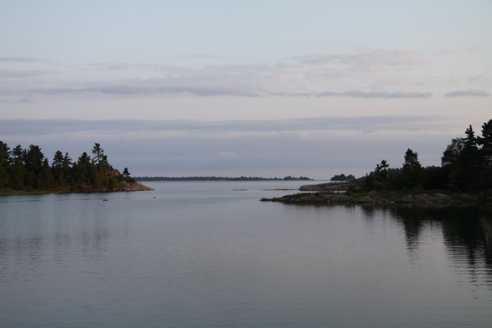
The trip is a 20 mile trip across open water and if the winds picked up it could be quite uncomfortable and bumpy. We made the trip in about 2 1/2 hours and anchored in a little bay of the behind the Burnt Island. There must be a dozen Burnt Islands in the 30,000 Islands. I’m sure that there is a story behind each one – I’m just not sure what they are.
Two more Looper boats joined us later in the morning – Lazy Dolphin and Serendipity. We joined them for a social hour at 5:30 and exchanged stories.
It is a very beautiful spot to anchor and as I said earlier if we get to a good WiFi location or a hard line, pictures will be posted.
However as you can see Brenda is enjoying herself.
Saturday August 7, 2010
Happy Birthday Laura!
We left Bayfield Inlet about 10:30 am and traveled out Alexander Passage to the open water. We traveled about 10 miles in the open water which was a lot calmer than yesterday. We reentered the windy route a mile 55 – again traveling among the rocks on each side. We decided not to go into Byng inlet but continue on down the North Channel to Cunninghams Channel. WE probably should have stopped at this point since it was about 1:30 and anchored behind Golden Sword Island. Instead we continued on through Rogers Gut . This was probably one of the hairiest areas of the trip because in parts only one boat could go through. While we did do a securite call before entering, this does not necessarily mean that other boaters are listening to their VHF radio or that they even have a VHF radio. From Rogers Gut we did the run out to the Bustard Islands – a godforsaken group of islands lying out from the mainland. As you can guess, I was not impressed and would not go there again. When we arrived the first anchorage was full. So we moved around the island and attempted to anchor in The Harbour. Again it was full but there was space to back in and tie to shore. Unfortunately the bottom was rocky making it very difficult to get the primary anchor to stick and there was a west wind blowing which kept blowing the boat away from from the shore. On top of that the shore was extremely steep. After several futile attempts to tie on to shore (with quite a gallery watching and after grazing the shore with the rear undercarriage of the boat) we left to anchor out in a small bay close to the open water. However this time we approached the shore bow in, dropped anchor and then dropped a second anchor off the back of the boat to stop swinging as the shores in the bay were both relatively close. The weather forecast called for strong winds around midnight. Once anchored, I dove under the boat to ascertain any damage caused when we grazed the shore. Fortunately, there was no damage.
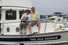
As I think about it now, I wonder why anyone anchors back into shore and ties up, when it seems so easy to drop an anchor off the back and achieve the same result. Tying off exposes the most vulnerable part the boat to damage – the props and the rudders. Whiles The Old Grouch is reasonably well protected since it is a single engine boat with a strong keel supporting the rudder and protecting the prop, it seems to me that those with two engines and their exposed props and rudders could do considerable damage by backing into the shore.
We left Bayfield Inlet about 10:30 am and traveled out Alexander Passage to the open water. We traveled about 10 miles in the open water which was a lot calmer than yesterday. We reentered the windy route a mile 55 – again traveling among the rocks on each side. We decided not to go into Byng inlet but continue on down the North Channel to Cunninghams Channel. WE probably should have stopped at this point since it was about 1:30 and anchored behind Golden Sword Island. Instead we continued on through Rogers Gut . This was probably one of the hairiest areas of the trip because in parts only one boat could go through. While we did do a securite call before entering, this does not necessarily mean that other boaters are listening to their VHF radio or that they even have a VHF radio. From Rogers Gut we did the run out to the Bustard Islands – a godforsaken group of islands lying out from the mainland. As you can guess, I was not impressed and would not go there again. When we arrived the first anchorage was full. So we moved around the island and attempted to anchor in The Harbour. Again it was full but there was space to back in and tie to shore. Unfortunately the bottom was rocky making it very difficult to get the primary anchor to stick and there was a west wind blowing which kept blowing the boat away from from the shore. On top of that the shore was extremely steep. After several futile attempts to tie on to shore (with quite a gallery watching and after grazing the shore with the rear undercarriage of the boat) we left to anchor out in a small bay close to the open water. However this time we approached the shore bow in, dropped anchor and then dropped a second anchor off the back of the boat to stop swinging as the shores in the bay were both relatively close. The weather forecast called for strong winds around midnight. Once anchored, I dove under the boat to ascertain any damage caused when we grazed the shore. Fortunately, there was no damage.
As I think about it now, I wonder why anyone anchors back into shore and ties up, when it seems so easy to drop an anchor off the back and achieve the same result. Tying off exposes the most vulnerable part the boat to damage – the props and the rudders. Whiles The Old Grouch is reasonably well protected since it is a single engine boat with a strong keel supporting the rudder and protecting the prop, it seems to me that those with two engines and their exposed props and rudders could do considerable damage by backing into the shore.
Friday - August 6, 2010
The winds have died down and we have departed for the north part of Georgian Bay. We traveled down the Shawanaga Inlet, through the Middle Channel, and passed a monument to Champlain who passed this way in 1615 – almost 400 years ago. What a wilderness it must have been then. I don’t know how they dealt with the bugs, but perhaps not taking showers or bathes helped. We didn't go into Point au Baril, but we did passed by the famoius lighthouse and the barrel on the rock. Rather than go through the channel at the end of the Point au Baril Channel, we traveled out into open water to rejoin the snall craft route into Hang Dog Channel. Hang Dog is a windy narrow channel of water that allows little room for error – rocks on both sides. I had heard that some boaters go completely outside to Bayfield inlet in order to avoid it. However if you go slow it's not that bad. We finally made it through, and we had a decision to make continue on for a while, find a spot to anchor or go into Bayfield and stay at Thompson Marina. Brenda elected the later, and went to Bayfield – a very, very small town and tied up at the marina for the night.
Thursday - August 5, 2010
We got up today ready to move on. Fortunately, I can get the Environment Canada web site on my new magical phone. The report was not good calling for strong winds between 20 and 33 knots all day and not diminishing until Friday. The VHF marine forecast confirmed this report. While normally that would not necessarily be a concern, our next step will take us through some tricky narrow areas exposed to Georgian Bay and its westerly winds. It could be difficult navigating through the channel without being pushed onto shoals. We decided to stay put until the winds died down. We are not in any hurry. This place is very pretty and nice and quiet with nice little beaches. Brenda has been going ashore looking at the plants and reading about them in the book she purchased in Parry Sound.
Wednesday - August 4, 2010
Before we departed Parry Sound, we filled our water tanks and had our holding tank pumped. I think we may be on the anchor for a few days . Departing Parry Sound under grey skies we went north to travel through the real Parry Sound – an area of deep water, passing Killbear Point and park and heading up the small craft channel.
The area is extremely beautiful but care needs to be taken as some areas are narrow and shallow. We heeded the warning on Chart 2203-1 and avoided going through Canoe past Spruce Island and coming back into the small craft route. We then followed the small craft route through to Shawanaga Inlet and ended our day anchoring in a small cove north of Anchor lsland and south of Josephine Rocks (just before Hopewell Bay). It was a good choice since it was sheltered and only three boats anchored there as opposed to Hopewell which was packed. Absolutely peaceful as the pictures which ultimately will show when I get to a better WiFi connection or a hard line so they can be posted. attached show. Brenda went ashore to look at plants and compare them to the book she bought in Parry Sound .
Tomorrow we head further north and go through Hangdog Narrows. I am a little nervous about it because of the winding nature and shallow water. The alternative is to go outside into open water which means we miss a beautiful area.
The sky was clear tonight and the stars were absolutely amazing to someone used to living in the city.
Tuesday, August 3, 2010
Tuesday - Ausgust 3, 2010
One of the reasons we come into Parry Sound was to do our laundry. Unfortunately the laundry in this Marina - Big Sound Marina had only one washer and drier to serve the entire Marina. It would take some time for us to do our laundry even if we had sole access to the machines. We found another laundromat about a 30 minute walk into town so this morning we walked into town. Had breakfast at a delightful little cafe on the corner of Gibson and Sequin streets. Great bread, and coffee. We then went looking for the library in order to access the internet. It appears the feds are putting up money for connectivity areas in the smaller towns. Outside the library was a nice little craft show with some unique items. If we did not have limited space on the boat we might have bought a few things. There is also an annual music festival going on in Parry Sound which has some noted artists playing. It would appear that they have summer homes in the area. When we returned to the boat we decided it was too late to venture out again, so we paid for another night and will leave on the "tide" tomorrow took my bike off the boat and went for a ride on an activity trail they have in the City.
Met an other three Looper couples and had drinks and snacks with them. More
interesting stories.
It's interesting to hear the goals of the various couples and where they intend to stop this year with the intention of putting their boat up and return home. One of couples has been living on their boat for five years! Just traveling.
This will be the last post for a bit until we can reach another town that has internet. However, I will be writing on the tip in word in order to cut and paste when we reach a town with internet.
Monday - August 3, 2010
lat 045 11 57; Long 080 07 60; fuel - 191.03 Eng 187.48
Left Echo Harbour about 11 to go to Parry Sound. Once we got out of the channel leading to Echo Harbour, we fell into line with 3 other Loopers who were also heading to Parry Sound. The South Channel is a pretty trip North with several narrow channels separating Islands. The trip was not uneventful! The crazies were still out since it was a holiday weekend. Several times we were in one of the channels when one or more go fast boats would zoom by us leaving a large wake which would rock the larger boats back and forth. While it may be fine for them, the rocking can sometimes push a boat closer into shore than would be advisable. Had drinks and dinner with a couple of other couples who have been doing the Loop for some time. Interesting to hear their stories since we have just started the Loop. I assume that we will also collect a number of anecdotes as we journey along.
Left Echo Harbour about 11 to go to Parry Sound. Once we got out of the channel leading to Echo Harbour, we fell into line with 3 other Loopers who were also heading to Parry Sound. The South Channel is a pretty trip North with several narrow channels separating Islands. The trip was not uneventful! The crazies were still out since it was a holiday weekend. Several times we were in one of the channels when one or more go fast boats would zoom by us leaving a large wake which would rock the larger boats back and forth. While it may be fine for them, the rocking can sometimes push a boat closer into shore than would be advisable. Had drinks and dinner with a couple of other couples who have been doing the Loop for some time. Interesting to hear their stories since we have just started the Loop. I assume that we will also collect a number of anecdotes as we journey along.
Saturday July 31 and Sunday August 1, 2010


Well we got up and thought about moving but Echo Cove was so nice and peaceful we decided to stay until Monday and just veg out. Hey, I’m retired, no need to stick to a schedule. So we just read books and I planned the route to Parry Sound. Here are a couple of pictures showing Echo Bay and our little mink.


Friday - July 30, 2009

July 30, 2010
We departed Indian Harbour about 10:30 am heading north to Echo Bay where we think we will stay until Monday morning. Being a long weekend in Canada, we anticipate the marinas and anchorages will be full, so probably best to find a nice spot and settle in for the weekend. Besides, it will give us a bit of time to decompress after the hectic last two weeks preparation for departure.
We right in assuming that it would be busy this weekend. Even though it is only Friday morning, the crazies are out racing to wherever. Several times we got rocked by boats running through the channel either coming up behind us or coming towards us. I sometimes wonder if these boaters realize the extent of their wake and while we can reduce the effect by steering across the wake, sometimes there is little room to effect a change of course, it can have detrimental effects on smaller boats. Nothing we can do about them however, just be prepared.
Traveling north through Big David Channel , we crossed some relatively open water until O’Donnell Point, around which is a narrow channel which leads to Twelve Mile Bay. As we approached the entrance to the Point we noticed that there were two sail boats with their sails up bu obviously under power coming through from the opposite direction so we backed off and waited for them to come through. Once around the point we decided not to go up Twelve Mile Bay but continued on the Frying Pan Island where we stopped for lunch at Henry’s. Great spot as everyone from this area knows. After lunch we moved the boat to Echo Bay on San Souci Island which is located in the Massassauga Provincial Park and found a anchorage for three days. Beautiful and quiet. Just beside our anchorage, a little mink kept scurrying back and forth doing whatever minks do. Lots of boats in the Bay for the weekend.
Thursday - July 29, 2009

July 29, 2010
Today we departed Penetang for Indian Harbour. Weather was cool and sunny. We travelled out through the Inner and outer harbor, turned to port and travelled up the west side of Beausoleil Island which is a federal park. Many many years ago, I took my open water certification at a YMCA camp located on Beausoleil, Camp Queen Elizabeth. Brenda was there also, 8 months pregnant with Laura and it was hot. Unfortunately, Brenda looked like a beached whale.
At the north end of Beausoleil, we passed through the Minnicognashene Channel an joined up with the main channel which ultimately will take us north to the North Channel. It is well marked but you do want to stay in the middle of the channel, for as we learned last year, variance to the port or starboard could lead to boat meeting rock which is not good.
It is amazing how many cottages are located along the route, some on little small islands and which are quite isolated and can only be accessed by boat. We also saw the monument to Samuel de Champlain along the channel commemorating his journey along this same route in the 1600’s in a canoe. It is daunting to think how those early explorers travelled through these waters without any charts or guidance. The place is loaded with dead ends and dead ends which lead nowhere, not to think of the insects that were there looking for food.
We followed the main channel through Muskoka Landing Channel and crossed open water to Kerr Island and marker Buoy C127 avoiding Monument Channel. We travelled through it two years ago and it is quite pretty and narrow, but I decided we could always visit again later.
As I continued along the main channel, I suddenly determined that we had missed the entrance to Indian Harbour. Turning around we went back to marker 127/1 and turned to starboard to enter Indian Harbour which is a beautiful sheltered area. We went into the harbor and found a place to lower our anchor. Unfortunately, I forgot to tighten the gypsy on the winchwhen I put the second anchor. Brenda untied the Bruce Anchor and it started falling freely with all the chain. Before I realized what was happening and could tighten the gypsy, about 250 feet of our 300 feet of chanin was on the bottom the harbor in 18 feet of water. The fortunate thing was I did stop it before all the chain was down there, and although it was covered with mud, we did recover it. I probably could recover if it had all fallen down, because I did bring my dive gear and it would have been a simple matter to attach a plastic bag to the free end and float it to the surface where we could recover it and bring it back on board. In any case no harm was done.
We then set anchor at 45 02 015 N 80 00 520 W and settled in for the night.
Subscribe to:
Posts (Atom)